June 18, 2022
The ranger provided us with a hiking trail guide for the 2.6 mile (4.2 km) trail. The trail is mostly flat and easy to walk. There is normally one climb to get to the top of the large Mound A. Unfortunately, the trail to the top of Mound A was closed due to erosion while we were there.
The trail guide provides information about each stop.

If you can’t walk the hiking trail, you can drive on the tram road and see much of the site. I noticed the ridges are numbered on the road so you can recognize the ridges.
We decided to hike the trail in the blazing heat of the Louisiana sun and humidity. We had water.
We started out behind the ranger station/museum and followed the directions to the picnic area.

Station 1 was “Top of the Dock.” Soil was added here to create a low ridge, hiding the rest of the site until visitors were at the top of the ridge. Once at the top of the ridge, they could see the mounds, and then with a few more steps, visitors, if the visitors looked back, they couldn’t see the dock they came from.

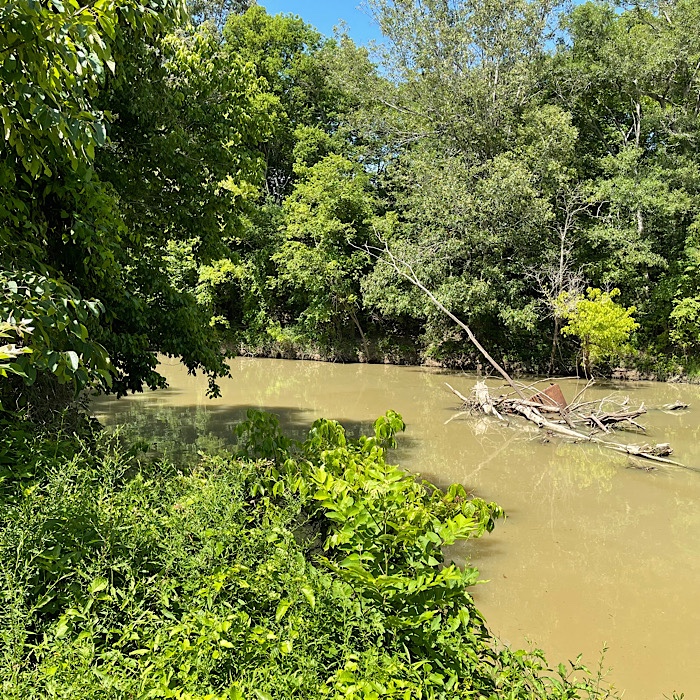
There is a gentle slope from the plazas down to the Bayou Macon, which made for easy access to the plaza from the bayou.

We walked down to the water in hopes of seeing an alligator, but didn’t see any.

Since we were walking up the ridge, I took a picture so you could see that the man made ridge hid the site. You can’t really tell this is a slope from the picture.

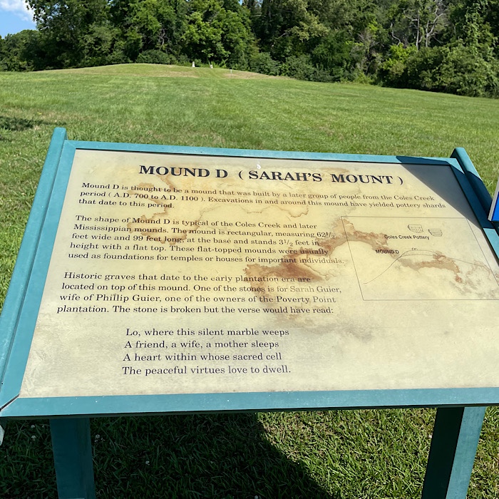
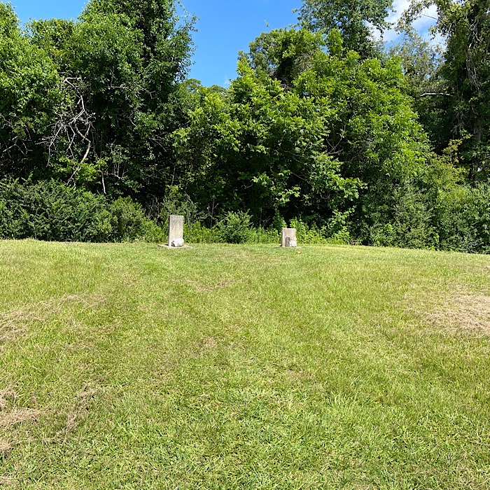
Station 3 is Mound D is much newer and built by the Coles Creek culture. It was built between 700-1100 AD. It is built on top of one Ridge 2 of the Poverty Point culture (1700-1100 BC). It has the graves of two women who lived in the area when the property was known as Poverty Point Plantation. They died in August of 1851. You can see their headstones.
Station 5 is an interesting stop. In the 19th century, it was a cemetery and was not plowed until the wooden grave markers rotted. Since it wasn’t plowed, the C-shaped earthen Ridge 1 is visible.
There is a large circle marked with white cylinders. Soil cores and excavation revealed the circles were made off large wooden post, up to 2.1 feet (65 cm) in diameter. Radiocarbon dating of the samples have the oldest post being from 1630 BC and the youngest from 1100 BC.

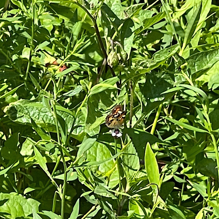
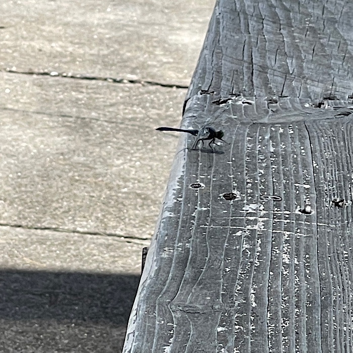
For Station 6, the guide talks tracing the path of Ridge 1 of the C-shaped earthworks. Tall grass has been planted on the ridges to make them easier to spot. The height of the ridges vary from .3 to 6 feet (10 to 185 cm). Looking back towards the plaza, the 45 acres (17.4 ha) is impressive. My pictures of the grass didn’t look impressive, but I thought you might enjoy the picture of the dragonfly in the tall grass.

Station 7 was a surveying monument. There are five surveying monuments in the site. These surveying monuments allow archaeologists to know precisely where excavations or artifacts are located. The elevation for the marker at Station 7 has an elevation of 99.209 feet (30.239 m) above sea level. It is a long way down from the mile high city in Colorado!

Station 8 was in the shade, which was lovely after walking in the sunshine. Station 8 marks “The Causeway.” The Causeway was built as an elevated road across a low wet area. It provided a rout out of the site. The Causeway was constructed sometime after 1410 BC.


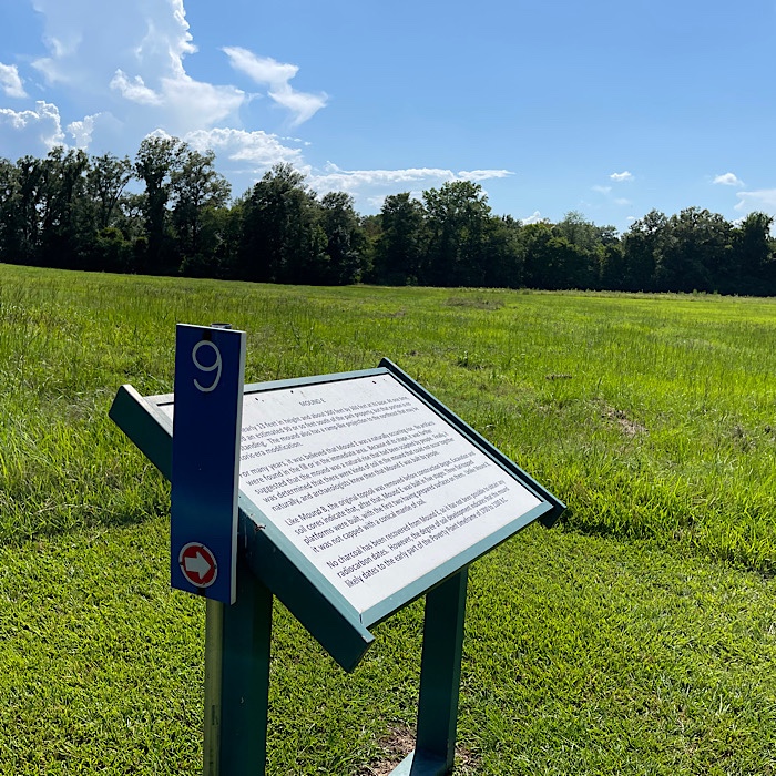
Station 9 was information about Mound E. The purpose of Mound E is unknown; no evidence of houses or other activities on or within the mound have been found. Archaeologists did find a piece of wood that radiocarbon dates the mound to sometime after 1500 BC. Archaeologists believe the mound was constructed during the early period of the Poverty Point culture.

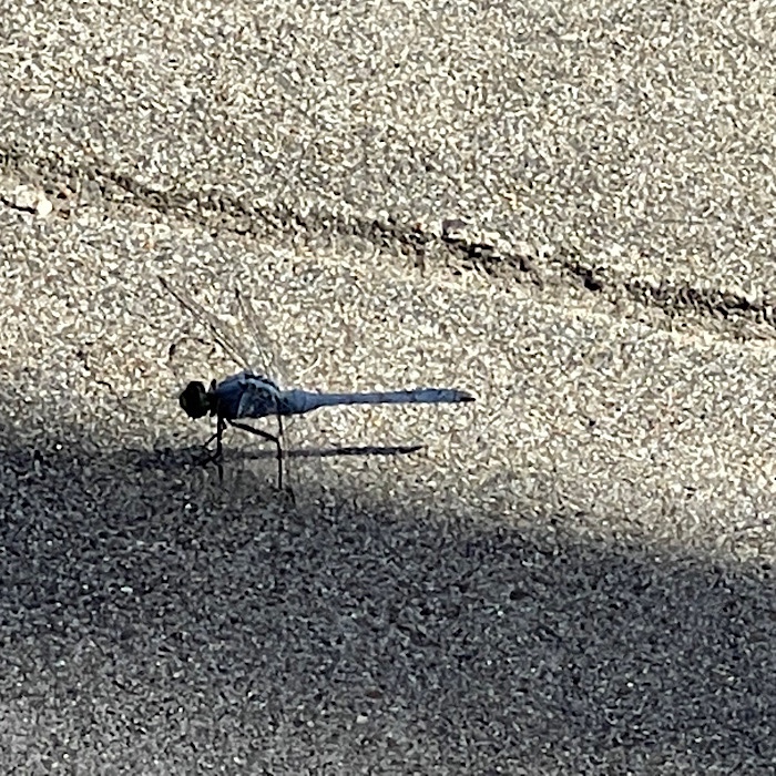
We stopped at the Contact Station to rest in the shade. The dazzle of dragonflies entertained us while we drank water and cooled down in the shade.

We walked on to Station 10. This station is the bottom of Mound A. Built about 1350 BC, Mound A is the largest mound built at Poverty Point or anytime earlier in US history. It reminded the largest earthen construction in the US for the next 2,000 years. We had hoped to walk up Mound A, but the trail was closed at the bottom. We didn’t get to climb Mound A, which is 72 feet (22 m) tall. This also meant we didn’t get to see the view from the top of Mound A.


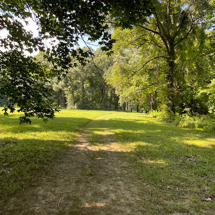
On the way to Station 12, we saw a raccoon. Station 12 was a borrow pit. There was a low depression formed by borrowing dirt to build the earthworks. It was easier to see the ridges here amongst the trees. This section hadn’t been farmed as much, leading to less soil erosion. The picture I took doesn’t look like anything. I am just going to show you the path from Station 10 to Station 12.
We walked to Station 13 and saw the Old Harlin Bayou. There wasn’t much to see here.
The park closes at 5:00 pm, so we had to cut our walk short. We walked back along the tram road. Bruce walked back to the truck and drove it to pick me up since I was hot ant tired.

We might go back and finish our tour. I recommend that you go in the morning, so you have lots of time to see everything.

Looks very interesting! Thank you for the detailed guide!
LikeLiked by 1 person
You would really enjoy seeing the mounds and artifacts. Since you are an archaeologist, you would get a lot more from the tour.
LikeLiked by 1 person
Thanks for doing that walking in the heat and humidity so we could see what it looks like! Seriously, you are tough troopers.
LikeLiked by 1 person
It was fun to see, I would recommend coming in the fall, winter, or early spring, not June on the cusp of July.
LikeLiked by 1 person
For some reason haven’t been able to like or comment on your blog lately. Hopefully you will get this comment, so if you do, know that I am reading and enjoying your blog 🙂
Maxx Trails
LikeLiked by 1 person
I can see your comment here. WordPress’s technology isn’t 100%.
LikeLike
Julia,
Thanks for all the good photos and history. Since you were able to do all that walking, I assume your ankle is much better – good news! Happy Father’s Day to Bruce.
LikeLiked by 1 person
My ankle is better and if I stay on the flat trails, it doesn’t bother me much. I got a compression bandage for my ankle today and it seems to be helping.
LikeLiked by 1 person
Thanks for the description of this park. Looks like a great place to visit. Kind of reminds me of Kolomoki Mounds State Park where we stayed a while back.
LikeLiked by 1 person
It is a great place to visit. I loved the interactive demonstration.
LikeLike